NAOS project 2016 Newsletter
The latest NAOS project 2016 Newsletter is hot off the press! Main themes : Observation of the global ocean – Preparation for the new decade of Argo Read previous newsletters on the NAOS project website
Jason-3 – providing data for the Copernicus Marine Service
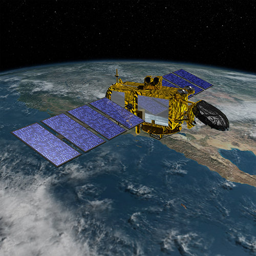
Pierre Bahurel (CEO of Mercator Ocean) explains why Jason-3 data is important for the Copernicus Marine Service. The launch of the Jason-3 ocean altimetry satellite last month was a huge boost for ocean monitoring. As well as continuing the unique time series of mean sea level measurements for climate monitoring, the satellite will also play […]
Ocean heat content and climate change: new scientific prospects
The study of the climate is by its very nature an interdisciplinary exercise: to understand how the climate functions, we need to study changes to the atmosphere, the oceans, landmasses and the biosphere in equal measure, as well as the way energy flows between them. Starting from the premise that climate change is linked to […]
Turning point in Altimetry : the Jason-3 satellite will be launched on January 17, 2016
The satellite Jason-3 will be launched on January 17th 2016. It is the follow-on altimetry mission of Jason-2. The objective of the Jason-3 mission is to provide continuity to the unique accuracy and coverage of the TOPEX/Poseidon, Jason-1 and Jason-2 missions. It will extend the high-precision multi-mission ocean altimetry data record to support operational oceanography […]
An intense El Niño event for the end of the year 2015!
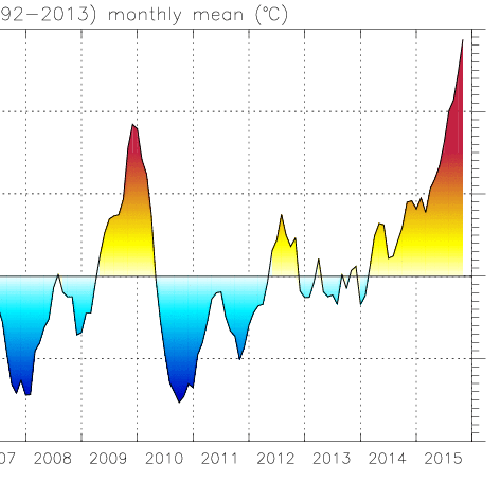
El Niño is a climate variation which results from the coupling of intense atmospheric and oceanic phenomena, mainly in tropical regions. During winter when it appears, El Nino has weather impacts around the globe. In the ocean El Niño is characterized by a strong warming of surface and subsurface waters from the central Pacific to […]
Canada’s global ice-ocean prediction system is now operational

Environment Canada and Mercator Ocean joined in a cutting-edge scientific collaboration for data assimlation and “ocean-ice” modeling domains thanks to a memorandum of understanding led by Meteo France. One of the missions of the Canadian Ministry “Environment Canada” is to predict weather conditions on a daily basis and to provide detailed predictions to its citizens. […]
Babette Tchonang wins EuroGOOS Kostas Nittis Medal for work on high potential of SWOT data in ocean forecasting
On 8 September 2022, EuroGOOS officially awarded Dr. Babette Tchonang this year’s Kostas Nittis Medal for her outstanding contribution to operational oceanography. During her doctoral research at Mercator Ocean International (MOi), Babette demonstrated that future Surface Water and Ocean Topography (SWOT) data could be readily assimilated into Mercator Ocean’s global high-resolution analysis and forecasting system. […]