COMBINATION OF ALTIMETRY AND HFR OBSERVATIONS FOR COASTAL DATA ASSIMILATION
PI and organization: A. Caballero (AZTI)
Co-Is: A. Rubio (AZTI), J. Mader (AZTI), L. Ferrer (AZTI), C. Dufau (CLS), M-H. Rio (CLS), G. Larnicol(CLS), N. Ayoub (LEGOS)
The MDT is a key reference surface needed for estimating the Absolute Dynamic Topography from altimetric Sea Level Anomalies and for their assimilation into ocean modelling systems. Global MDT solutions combine altimeter, gravimeter and in-situ data. The last solutions (CNES- CLS18) provides an accurate estimate of the MDT at spatial scales larger than around 25 km of resolution away from the coast. Nevertheless, in coastal areas, where in-situ measurements are sparse and the first guess is less accurate, the global MDT solutions are often less accurate than in the open ocean.
Nowadays, long time-series of high quality HFR velocity measurements are available in the European coasts, with an increasing trend in the number of HFR systems being installed along the European and world ocean coasts. These databases could be an important source of surface currents measurements to improve the global MDT solutions in the coastal areas.
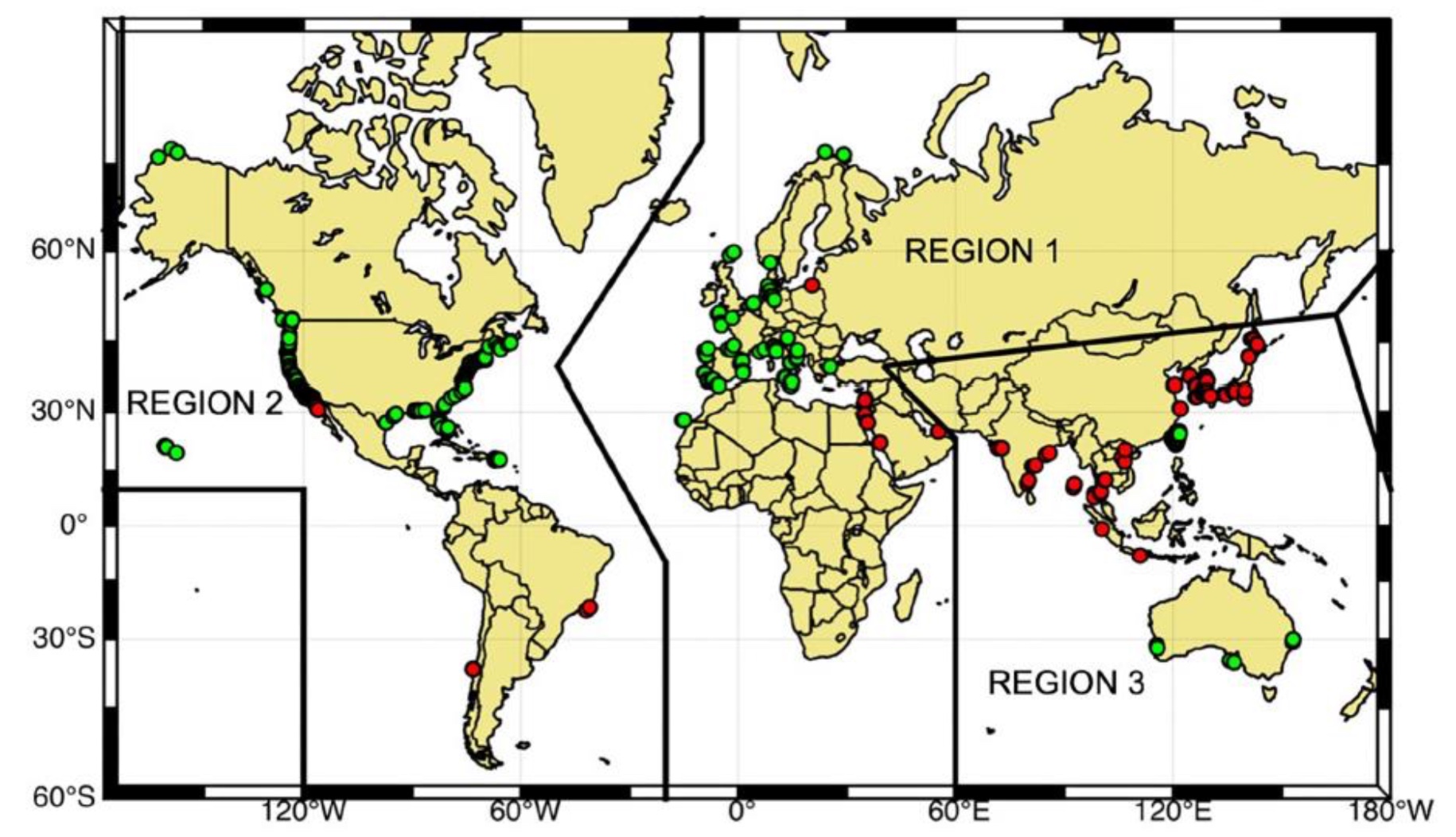
Figure 1. Global distribution of HFR stations (green dots: stations that are sharing their data through the global network and red dots: stations that are not currently sharing their data), from Roarty et al. 2019.
In COMBAT project we proposed to showcase the benefit from including HFR data to calculate an improved solution for the MDT. Thus, we have benefited from the 9-year long HFR data set provided by the EUSKOOS network (https://www.euskoos.eus/, south-eastern Bay of Biscay) as input in the computation of the MDT.
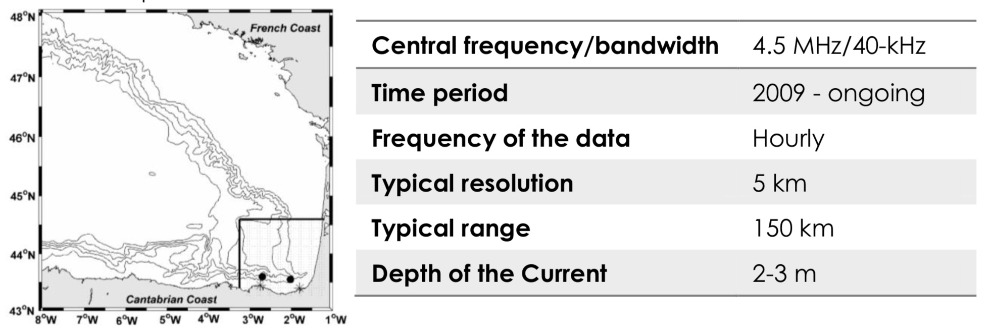
Figure 2. (Left) Footprint area of the HFR system (square), location of the two corresponding antennas (asterisks) and of the two slope moorings equipped with ADCPs within the Bay of Biscay. Isobaths (m): -200, -1000, -2000, -3000, -4000. (Right) Main characteristics of the HFR system.
The main conclusion from this project is that the obtained MDT resolves better the mean circulation of the study area. It therefore suggests that the method of calculating MDT, taking into account the information provided by the HFRs, makes it possible to obtain a more accurate and realistic MDT and could therefore be generalised to other areas. In addition, HR numerical simulations are a useful tool for testing different approaches needed to process the in-situ data before using them in the MDT computation.
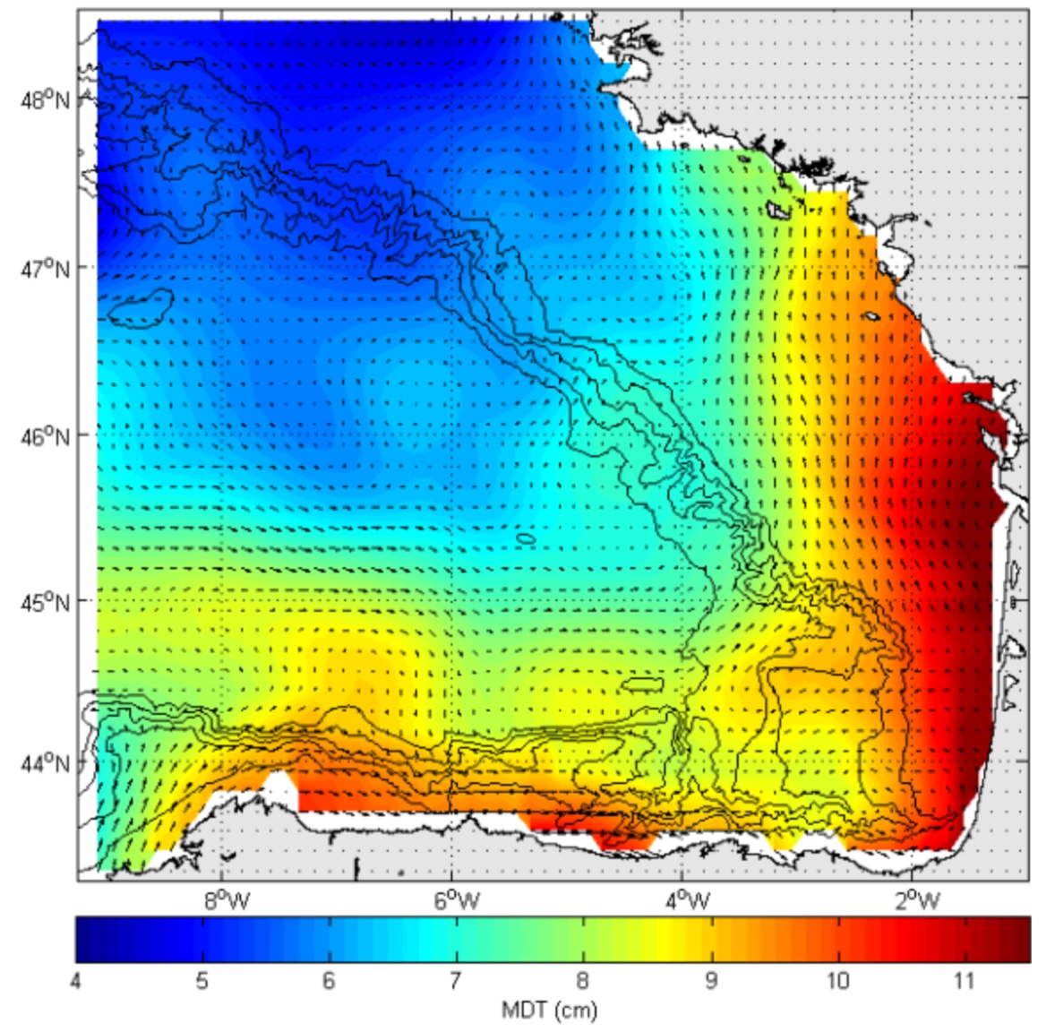
Figure 3. COMBAT Mean Dynamic Topography for the southeast Bay of Biscay.
The uptake by CMEMS of this project is an improved methodology to incorporate HFR currents in the MDT computation and obtain an estimation of the error from HR numerical models, and the following products:
- New regional MDT
- New L4 gridded ADT
These products and methodology could benefit the CMEMS TACs and MFCs as indicated in the following figure.