Mercator Ocean is a scientific partner of the PIRATA-FR32 expedition.
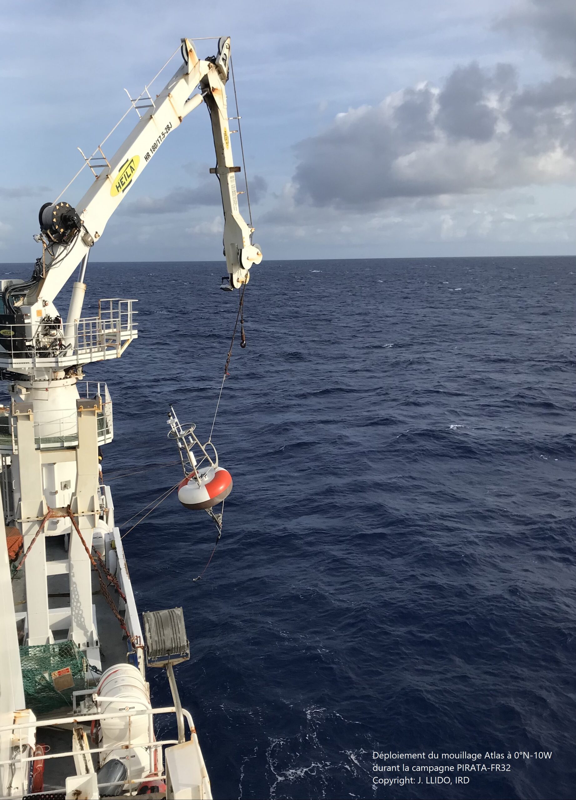
PIRATA-FR32 mission is part of an international collaborative programme involving France, Brazil and the United States. The French team will be on board the research vessel Thalassa of the French Oceanographic Fleet for 39 days at sea on 28 February 2022.
The objective of the mission is to maintain a network of observational buoys essential for studying ocean-atmosphere interactions in the tropical Atlantic Ocean in order to make seasonal, weather, climate and ocean forecasts. These observations are useful for forecasting the African monsoon, or tropical cyclones for example.
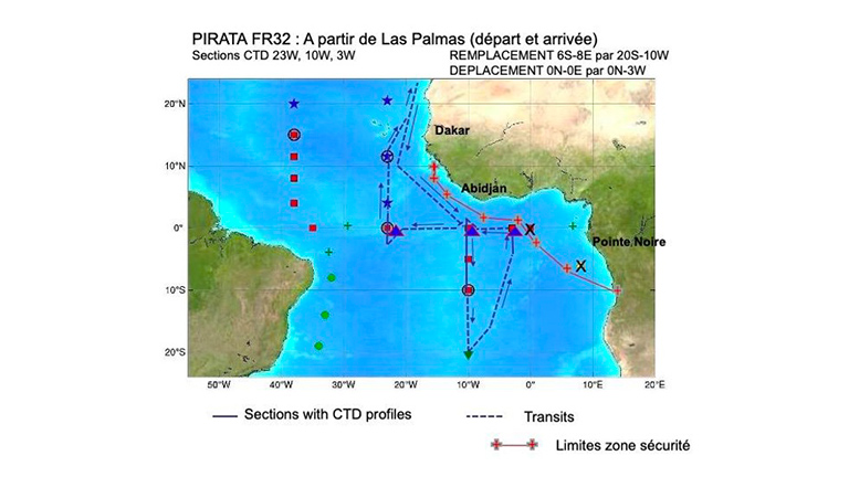
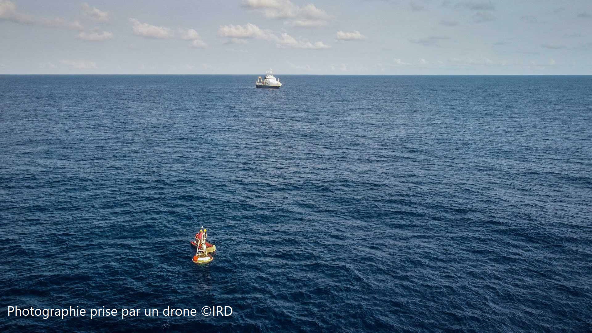
Eighteen permanent moorings measure the meteorological and oceanic conditions on a continuous basis; see figure at left. France maintains six of them in the central and eastern part of the basin, on the Gulf of Guinea side.
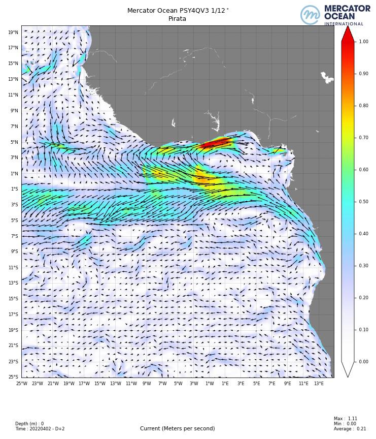
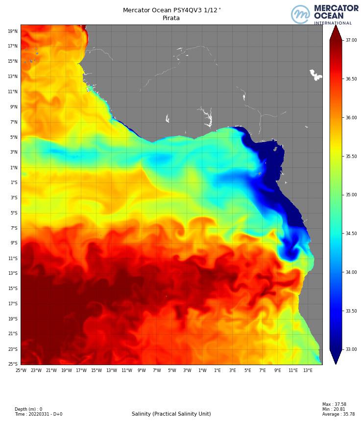
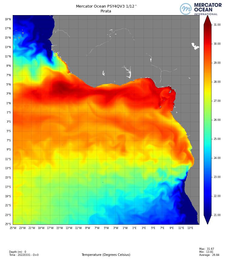
Every year for the past 20 years, Mercator Ocean has provided daily current, temperature and salinity forecast maps for three time periods, the day’s analysis and forecasts for the next two days. These maps are available from 2am GMT, after each run of Mercator’s global daily forecasting model on a grid of about 8km at the equator. They arrive directly on board.
“During SNO PIRATA’s oceanographic campaigns, the ocean current, SST and SSS forecast maps provided by Mercator Ocean are used on board to get a first estimate of the conditions encountered in the working area, explains Jérôme Llido from Legos.They can be consulted before our arrival in the area for the lifting/deployment operations of the PIRATA moorings, compared to the indications of the instruments on board (S-ADCP, TSG) or to optimise our timing in transit. The SST/SSS distributions allow us to see if we are crossing a front zone (meanders etc), and the current maps can be associated with the Sargasso distributions. The SST maps are also used for the ship, in particular to optimise the air-conditioning and engine cooling settings using seawater.”
This feedback indicates that MOi’s essential descriptive parameters of the physical state of the digital ocean are used during the campaigns at sea in different fields of application such as the knowledge of the mesoscale configuration of the area in terms of eddies, the optimisation of navigation and thermal regulation on board, lifting operations, deployment of moorings, as well as the presence of sargassum seaweed which is carried by the currents. This representation of the environment is a major asset for the success of the mission.
Other publication (in french): La 32ème édition de la campagne océanographique PIRATA | océans connectés (oceansconnectes.org)
Learn more about the organization and data collection of this observation network, click here (article moorings/Pirata folder/”Océans connectés” in french)