
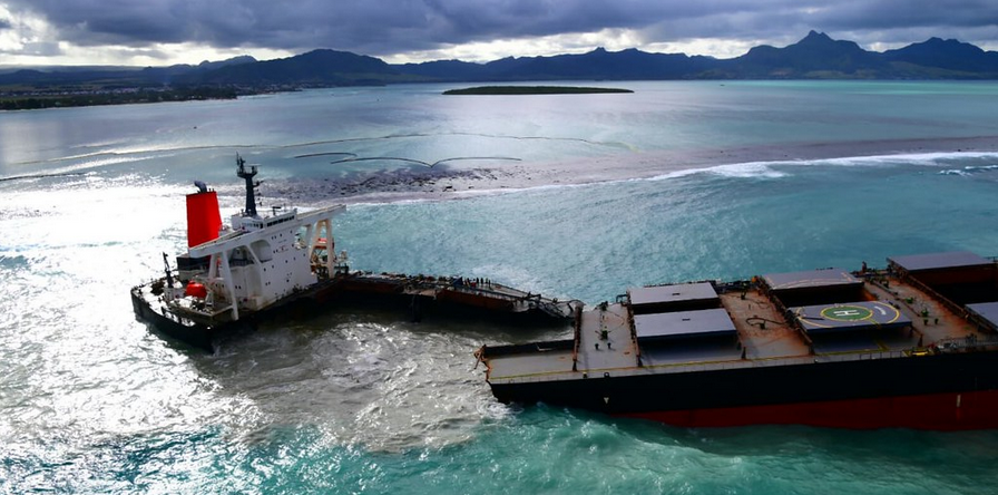
One of the worst oil spills in the Indian Ocean recently occurred when the Wakashio bulk carrier ran aground on July 25 on a reef in southeast Mauritius. The vessel broke in two on August 16 and the bow part was towed offshore to be sunk. The environmental effects have been devastating and responders have relied on oceanographic forecasting systems to assess and stem the damage.
Nearly 3,900 tons of very low-sulfur fuel oil, 200 tons of diesel and 90 tons of lubricant were transferred off the vessel. The Mauritian authorities estimated the quantity of pollutants released at sea to be between 800 and 1000 tonnes (1). The spill has impacted sensitive zones including Blue Bay Marine Park, Ramsar sites, and the Ile aux Aigrettes nature reserve, home to the last remnants of Mauritius’s dry coastal forest and the endangered species that depend on it (2).
Mercator Ocean international (MOi) provides MF with ocean current forecasts in order to feed the MOTHY pollutant drift model to forecast the oil spill trajectory. Such ocean currents are produced by the MOi ocean monitoring and forecasting system. MOi operates a global ocean system that describes, analyses and forecasts the state of the ocean in operational conditions. This is possible thanks to an ocean and sea ice numerical model that embeds in situ and satellite observations through a data assimilation technique. Such techniques ensure that ocean forecasts accurately represent ocean behavior and that uncertainties stay minimal. The ocean current product is then integrated by MOi into the Copernicus Marine Service portfolio under the reference Global ocean Physics analysis and forecast (001_024). The latter embeds marine in situ (013_030) and satellite observations (sea level 008_044 and sea surface temperature 010_001) through data assimilation to reduce forecast uncertainties, assuring accuracy for oil spill responders. Such products allow MF to forecast the potential Wakashio oil spill trajectory and estimate the ensuing consequences hours and days in advance. A mandatory requisite is that these are able to accurately track oil spills.
MF also uses a global wave product produced by MF that is then integrated by MOi into the Copernicus Marine Service portfolio. This product (under the reference 001_027) is used to analyze and provide expert forecasts on the sea state on the operating areas. The Copernicus Global Ocean Wave Forecasts (001_027) are produced daily at Meteo France and distributed within the Copernicus Marine Service portfolio. The latter embeds satellite wave observations 014_001 through data assimilation to reduce forecast uncertainties.
MF uses several data sources to support the authorities in charge of crisis management. For example, they provide meteorological and oceanic information and forecasts of the trajectory of the oil slicks and wreckage. The two products detailed above are respectively produced by MOi and MF and then integrated into the Copernicus Marine Service portfolio by MOi, gathering all marine data from various sources (in situ sensors, satellite observations and numerical ocean and sea ice models) and producers into a single one-stop-shop service. All Copernicus Marine products are available free-of-charge for all users worldwide, allowing all meteorological services and operational oceanography centers globally to use this information in their own local pollutant drift models to forecast potential oil spill trajectores in their respective marine areas of responsibility.