
Madeira Oceanic Forecasting System: Global to Regional
Madeira Oceanic Forecasting System: Global to Regional
Context
The Madeira ocean circulation modeling system first started with climatology at the oceanic boundaries and reanalyzed atmospheric boundary conditions from NCEP. The spin-up period of the Regional model lasted 3 years until April 2010, and the forecasting mode started in May of 2010. In the forecasting
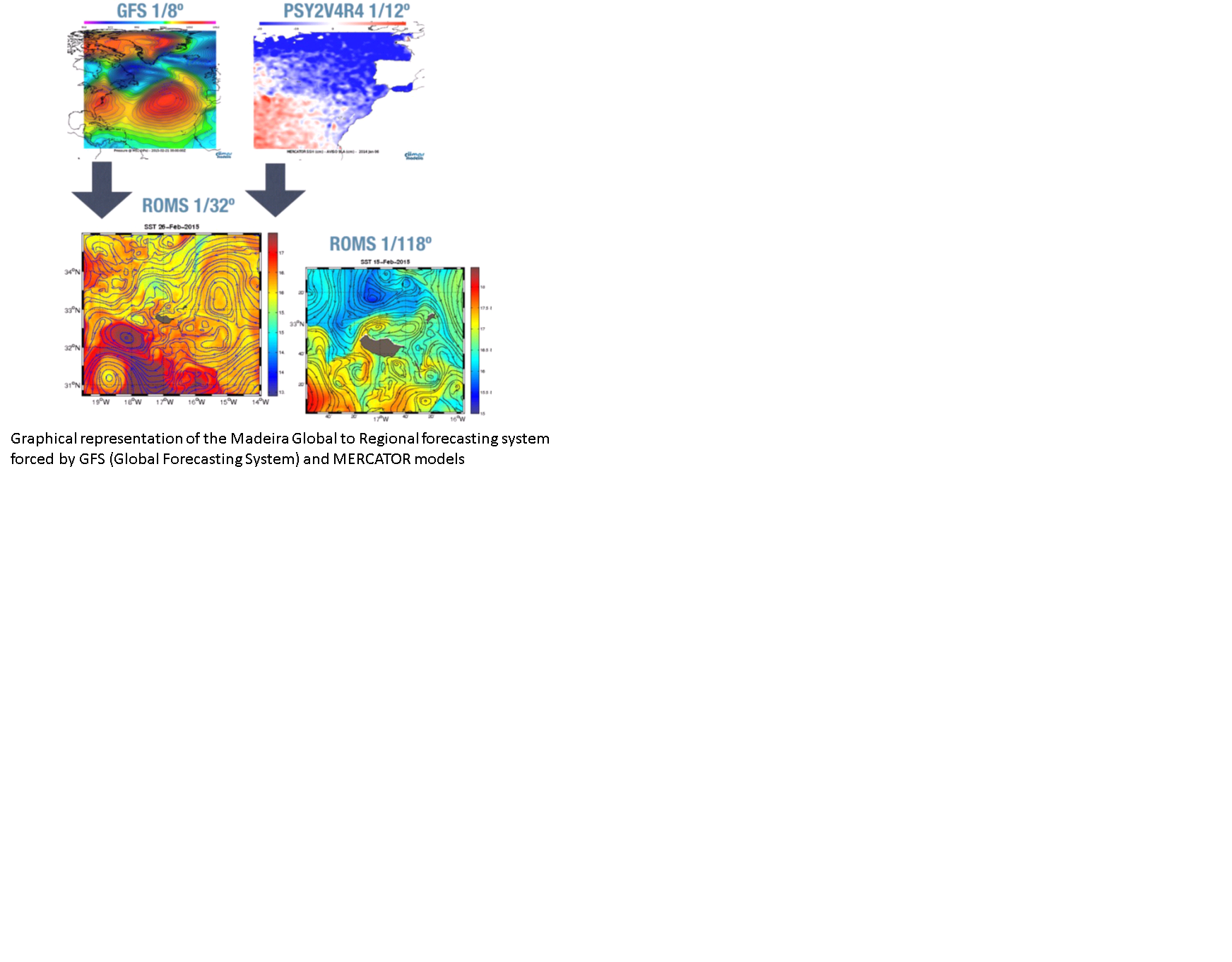
model the ocean climatology was replaced by the global model solution and the atmosphere by its forecasting counterpart i.e. GFS. Every week, the real time MERCATOR global model solution (PSY2V4R4) is used to force the Regional Oceanic Modeling System (ROMS). Two nested grid inside ROMS allow the increase in spatial resolution from 3km down to ~900m.
Results
MERCATOR is very useful to force our Regional ocean Modeling System (ROMS). Non-spite the cold bias in higher latitudes and warm bias in tropical and sub-topical regions, the surface currents are well represented. A change in ENVISAT altitude has degraded the altimetry data and thus the data error is considered acceptable between 2-5 cm, which encompasses a great extent of the anomalies calculated for the Madeira Archipelago Region with MERCATOR and with ROMS. Thus until new satellites with higher resolution are launched it will be hard to validate and consequently improve the model SSH. Weak spatial resolution (1/4º) of the assimilated Reynolds SST also poses some limitations in model corrections, specially if they induced patchy overestimations (MERCATOR) in smaller regions and 10 patchy underestimation (ROMS) in others. For Madeira, an accurate representation of the sea surface temperature is important since the leeward side of the island is often 2-6ºC warmer than the surrounding oceanic region, with subsequent impacts on the local atmospheric dynamics (see Caldeira and Tomé, 2013). This temperature gradient is important for biological activities such as mariculture, which is wiling to rely on our forecasting system to further develop their production in the Region. In the future, the Regional Madeira Archipelago configuration should have a coupled atmosphere-ocean system in order to better represent the SST fields. Recent (unpublished) studies have demonstrated that the best way to replicate the warm wake which often occurs in the leeward side of the island is to have correct radiation fluxes, which can only be achieved with coupled atmosphere-ocean modeling systems. With one-way and/or uncoupled (offline) systems, atmospheric models often have different SST fields relative to the 3D ocean circulation model, thus providing erroneous and incompatible fluxes. In the scope of the recently formed Oceanic Observatory of Madeira (OOM: http://oom.arditi.pt), the collection of new and systematic datasets are expected to help improve the Regional forecasting systems.
Usage
At the beginning, PSY2V4R4 was used to force the Regional Oceanic Modeling System ROMS. IBI36 is used now.
Mercator Products
Real Time : Temperature, Salinity, velocities (U, V) and Sea Surface Height at 1/12°.