
Connecting the world around ocean forecasting
Why is there an OceanPrediction Decade Collaborative Centre?
The Decade of Ocean Science for Sustainable Development 2021-2030 is being coordinated by the Intergovernmental Oceanographic Commission of UNESCO (IOC-UNESCO) to promote transformational, large-scale change to advance urgent action on moving from the ‘ocean we have’ to the ‘ocean we want’.
The OceanPrediction Decade Collaborative Center (OceanPrediction DCC), hosted by MOi, is a Decade cross-cutting structure that will work at the global scale to develop collaboration between Decade Actions and other key actors related to ocean prediction (see the section “Ocean Prediction…. what is it and why it is important?”).
Mission
A predicted ocean based on a shared and coordinated global effort in the framework of the UN Ocean Decade.
Vision
To galvanize and coordinate efforts towards the co-development and integration of worldwide ocean prediction activities, serving Decade objectives and in close collaboration with the Decade endorsed actions and other stakeholders.
Pierre Bahurel, Director General of Mercator Ocean International, explaining what the OceanPrediction Decade Collaborative Centre is.
What are the objectives
of the OceanPrediction DCC?
A global community
To provide a backbone collaboration structure and collective voice to the ocean prediction community, supporting the Decade implementation. This community will be formed by individuals and institutions with a wide range of profiles, including scientists, private companies, policymakers, and users.
A technical infrastructure
To build a global technical and organisational structure, focused co-design with Ocean Decade actions and other relevant actors to develop a new scenario for ocean forecasting that will be based on interoperability and an architecture to ‘deliver as one’, leveraging the coming innovations derived from the digital twining concept.
Enrique Alvarez, Technical Coordinator of the OceanPrediction DCC at MOi, explains the role of community and the need for a coordinated global technical and organisational structure for ocean prediction activities.
PIERRE BAHUREL
Director General of Mercator Ocean International.
 A Decade Collaborative Centre dedicated to ocean prediction
would not only have a coordinating role, bringing together a broad range of user communities to be a part of this incubator and co-design mechanism, but it will also work to deliver. We want to foster an ocean science-to-service approach to develop powerful ocean prediction capacities around the world for a sustainable ocean, giving every citizen on our blue planet the power to understand what is happening or will happen in our ocean, and ultimately to our planet.
What are the OceanPrediction
DCC collaborative structures?
To achieve their objectives, OceanPrediction DCC will develop two types of collaboration structures worldwide:

REGIONAL TEAMS:
focused on community development and capacity building and are organized by geographical regions

OCEAN FORECASTING GLOBAL CO-DESIGN TEAM:
focused on alignment for co-design and formed by experts on different topics of the ocean forecasting value chain
Having different teams for the technical aspects and community building will allow for efficient management; a smaller team of specialists will deliver technical results on time and a larger geographically based structure will integrate the community and catalyse the governance and organisational components.
Join the OP DCC Community
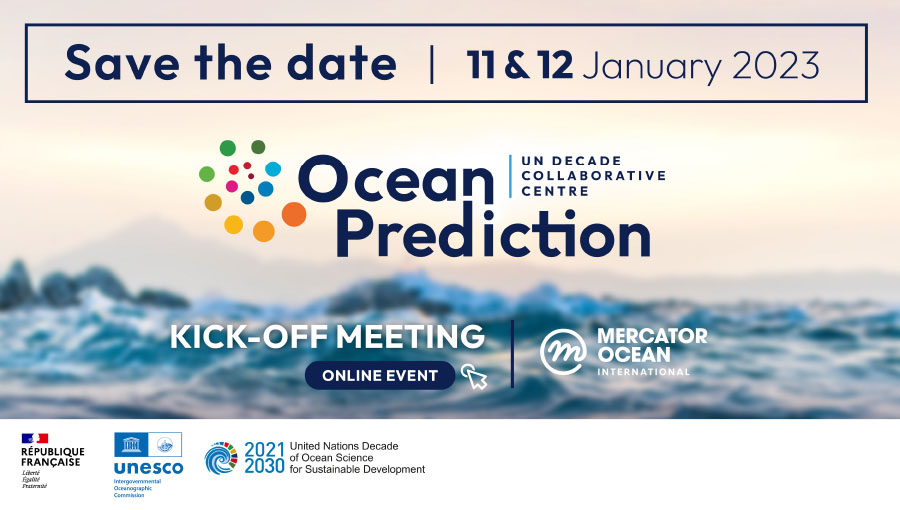
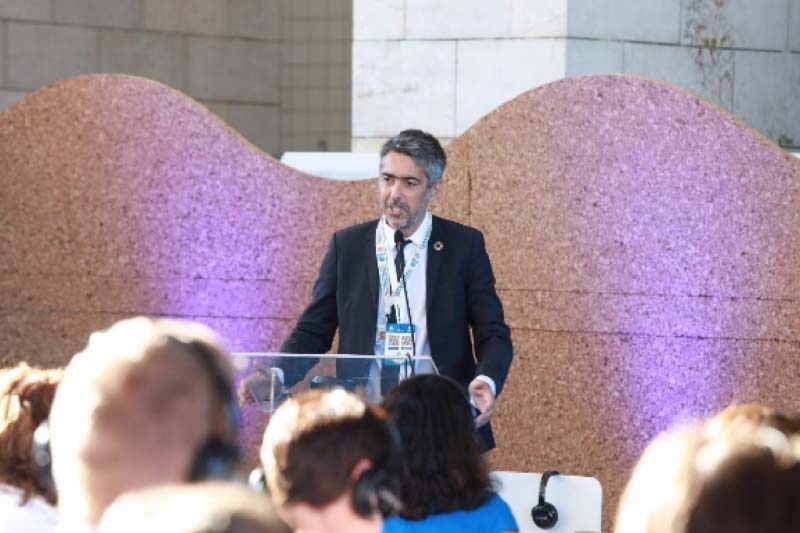
The official kick off of the OceanPrediction DCC will take place in an all virtual event from January 11 to 12, 2023. It will include networking features such as chats, business cards, posts, and surveys, allowing our community to meet and connect. A wide audience is expected, from scientists, to users, to decisionmakers, to interested citizens.

VLADIMIR RYABININ
Executive Secretary, IOC-UNESCO
A key element in sustainable management of the ocean
is strong and authoritative ocean prediction, including a digital representation of the ocean. These provide objective means for managing the ocean, increasing the transparency of decisions and our ability to use the ocean in more sustainable ways. This is one of the most important initiatives that we can have in the Decade, which will even spill over the timeframe of the Decade. A Decade Collaborative Centre for Ocean Prediction would serve as an incubator and co-design mechanism for ocean and coastal data processing, forecasting and modelling, culminating in a digital twin of the ocean, and taking ocean science beyond traditional institutional stakeholders.
Ocean Prediction… what is it
and why is it so important?
The ocean covers more than 70% of our planet and provides life-giving ecosystem services that make life as we know it possible. Nearly 40% of the global population lives within 100km of the coast, a population density that is two times the global average (1). The ocean drives and helps regulates weather and the global climate. It provides food security and livelihood for billions of people, ecosystems services such as absorbing atmospheric CO2 and producing oxygen, genetic resources for the marine biotechnology industry, trade and transport routes, sources of renewable energy, mineral resources, recreation and tourism, and much more. The ocean economy is expected to grow to USD 3 trillion by 2030, employing some 40 million people (2).
To use the ocean sustainably and ensure protection for fragile marine ecosystems, we must monitor and understand how the ocean functions and predict how it will behave in the future as it responds to multiple pressures such as pollution, overfishing and climate change. We measure ocean variables such as temperature, salinity, oxygen, carbon, and chlorophyll to monitor the ocean and ecosystem functioning using global networks of ships, moorings, buoys, and automated underwater vehicles. Together with ocean-monitoring satellites, these data provide a real-time snapshot of ocean conditions.
This snapshot, however, has two limitations: 1) it only offers a glimpse of the ocean in those areas where measurements are available (which are particularly sparse in remote regions such as the Southern Ocean and deep sea); 2) it only captures the status of the ocean over the lifetime of the instrument – it cannot see into the future.
Ocean forecasting is a technique that overcomes these limitations by using algorithms and computer models built on scientific knowledge of how the ocean works to fill in the gaps where data are sparse, to connect a series of these snapshots into a moving picture, and to run that picture forward in time to predict future conditions. This is the same technique used by meteorologists to make weather forecasts that we use in our daily lives.
Forecasting and observing systems work together and in a complementary way. The numerical models need the data from observations for validation of model results and, equally important, to obtain a realistic description of the present conditions in the ocean that serves as starting point for the forecast. This technique for the ‘initialization’ of the model with measured conditions is called ‘data assimilation’ and is vital to obtain realistic forecasts. Conversely, when models fail to reproduce the real ocean, this helps to target where our understanding of ocean processes and ecosystems is weak, requiring additional research and data.
Operational Ocean Forecasting Systems around the world routinely provide ocean forecasts needed for a wide range of activities such as navigation and maritime safety, search and rescue operations, pollution monitoring and response, marine spatial planning and coastal zone management, fishing and aquaculture, and disaster risk reduction and response (hurricanes, tsunamis, storm surges and flooding). The numerical models that are in the core of the ocean forecasting services are also used by scientists to explore global ocean and climate trends such as warming, marine heat waves, sea ice melt, shifting circulation patterns, CO2 uptake, acidification, deoxygenation, and changes to marine ecosystems.
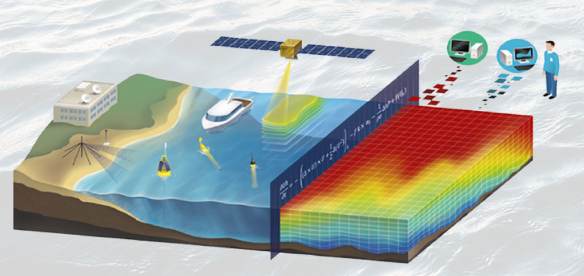
An artistic representation of an ocean forecasting system, including its most important elements: satellite and in situ observations and the solution of the numerical model, that is produced on the points of a tridimensional grid. Source: Mercator Ocean International
New innovations in machine learning and artificial intelligence are leading to the development of digital ‘twins’ of the ocean – a realistic and interactive representation of the real ocean, with numerical models at its core, that allow us to explore scenarios of how the ocean and its ecosystems would change in response to a particular action, such as reducing CO2 emissions, establishing marine protected areas, and regulating fishing.
A detailed description of the world around ocean monitoring and forecasting can be found in the ETOOFS Guide, a guide on implementing Operational Ocean Monitoring Forecast Systems. Initiated at the request of IOC-UNESCO and the World Meteorological Organisation (WMO), the guide was funded and produced by the Global Ocean Observing System (GOOS) and its Expert Team on Operational Ocean Forecasting Systems (ETOOFS), and Mercator Ocean International.
Using Ocean forecasting as a focal point to foster intercultural dialogue towards the ocean we want